Red Rock Utah: Arches and Canyonlands
Moab sits in a deep gouge in the Colorado Plateau, surrounded by rock in every direction. Drive in from the north and the canyon walls close around you so gradually that by the time you notice, you’re already inside something enormous. That feeling — of being held inside the landscape rather than looking at it from the outside — never fully left for the entire trip.
Arches National Park
The park is smaller than you might expect, and more crowded than you’d hope, but neither of those things diminishes what it holds. There are over 2,000 documented arches within its boundaries — the highest concentration anywhere on earth. The question isn’t whether you’ll see something remarkable, it’s whether you can slow down long enough to look at it properly.
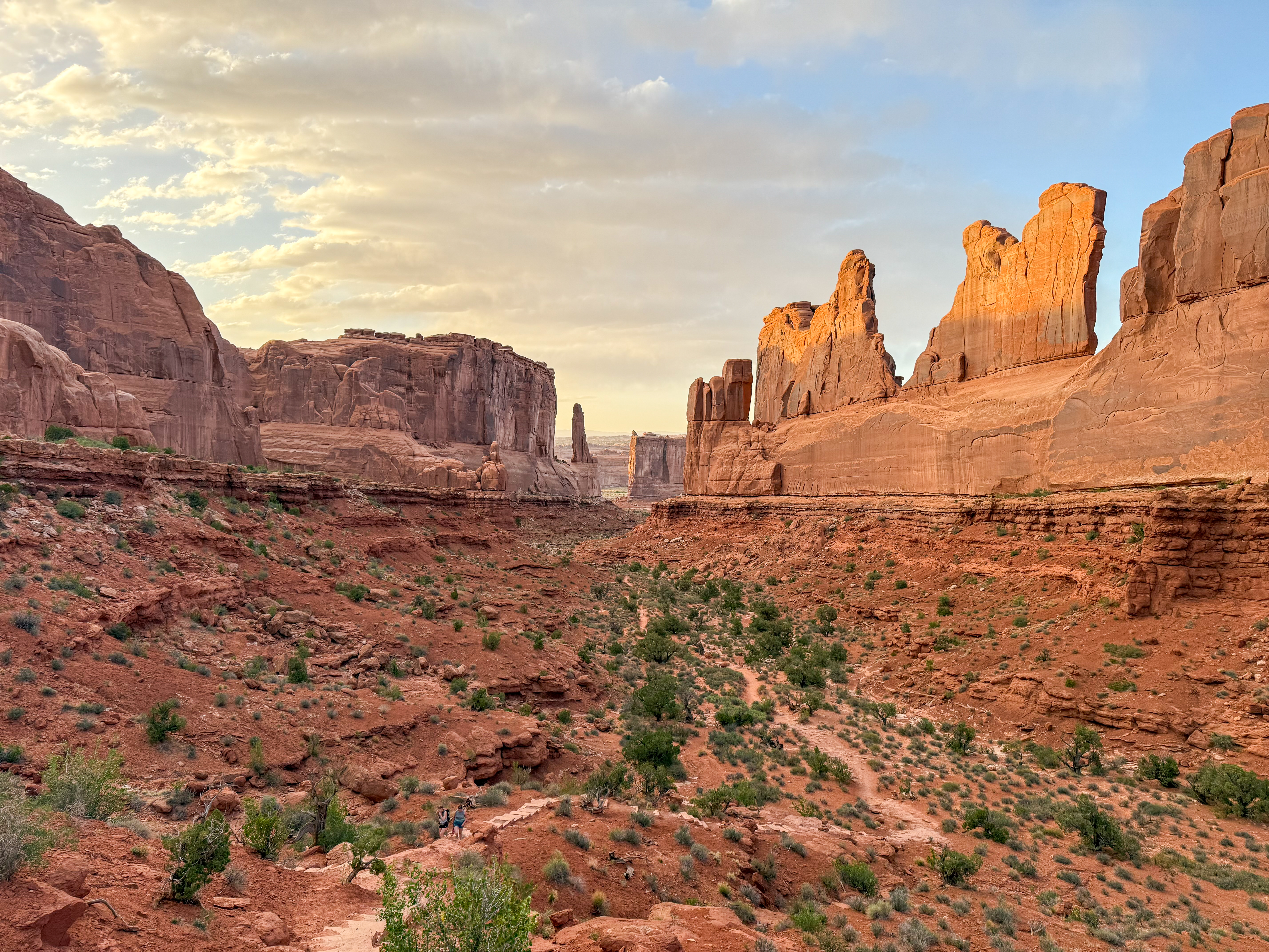
Park Avenue is the first major stop and sets the tone perfectly. A row of sandstone fins towers above the road like the walls of a city that was never built. I arrived late in the afternoon and the light was doing what desert light does at that hour — turning everything amber and copper and making even ordinary rock look like something you should photograph.
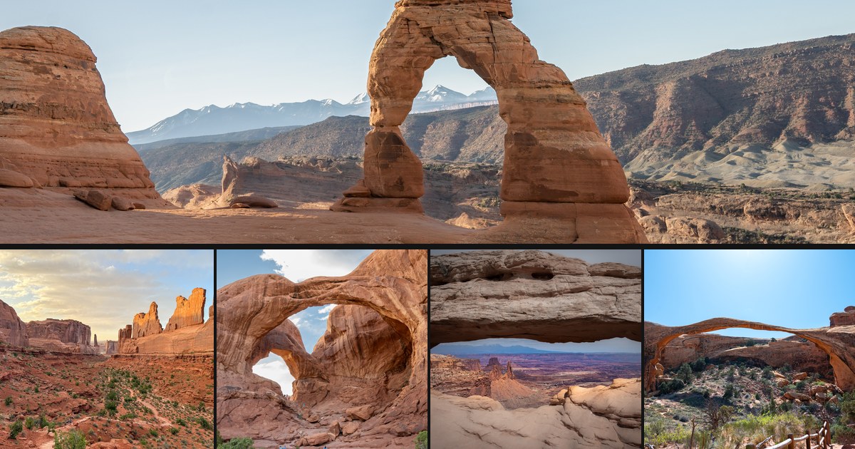
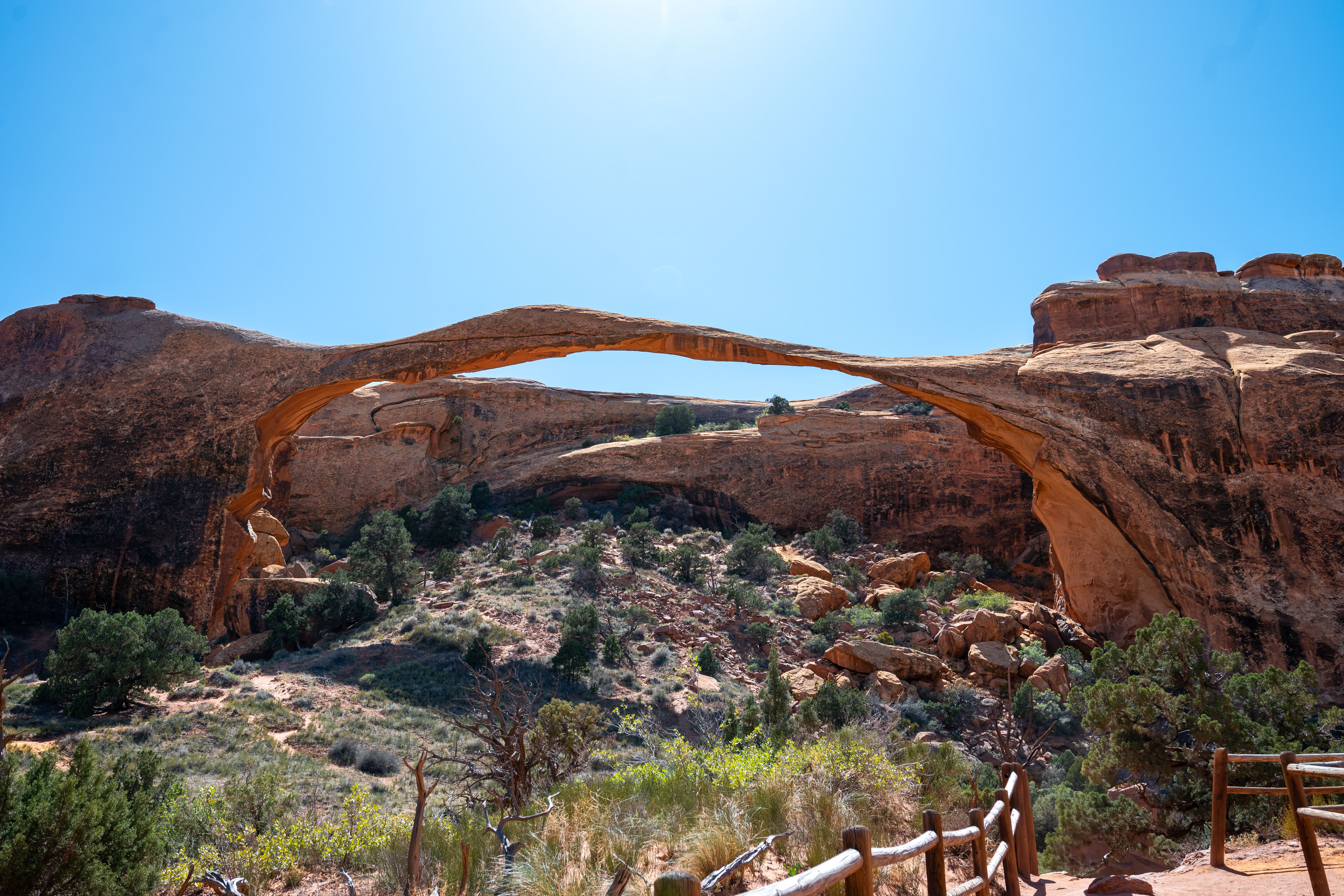
Landscape Arch is one of the longest natural arches in the world — a ribbon of rock 88 metres across that looks too thin to be standing. The trail to it is easy, which makes the payoff feel slightly unfair. You round a corner and there it is, impossibly long, hanging over the slope like something mid-collapse. I spent a long time looking at it from different angles, trying to understand how it was still there.
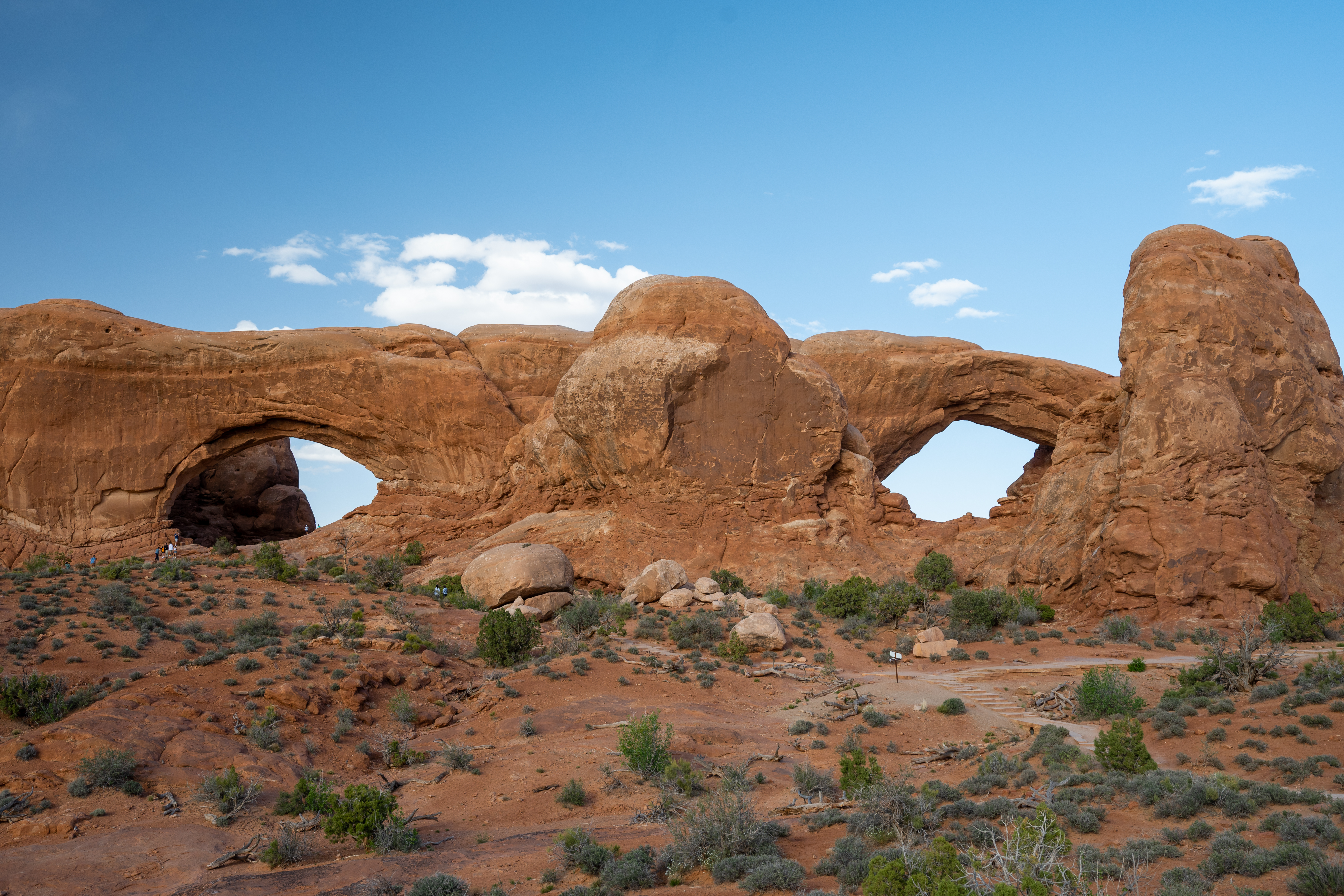
The Windows section is where the crowds gather, and fairly so. North and South Window sit side by side in a curved rock face, framing views of the park’s interior that reward patience. Come early or come late.
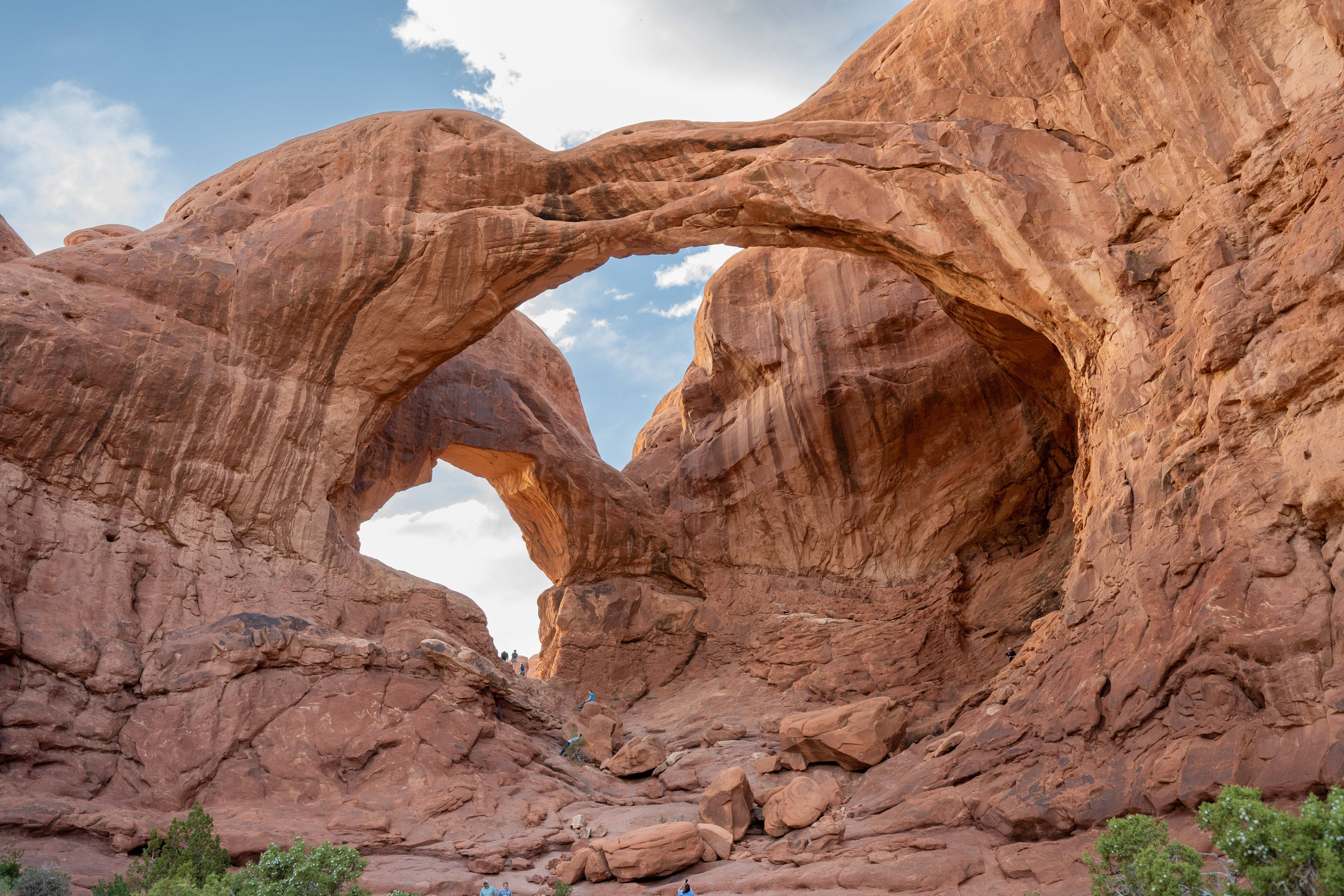
Double Arch is something else. Rather than a window in a wall, it’s two arches joined at the hip and soaring overhead — you walk under them and look up into a gap of blue sky framed by tonnes of red rock. The scale is hard to photograph honestly, but I tried.
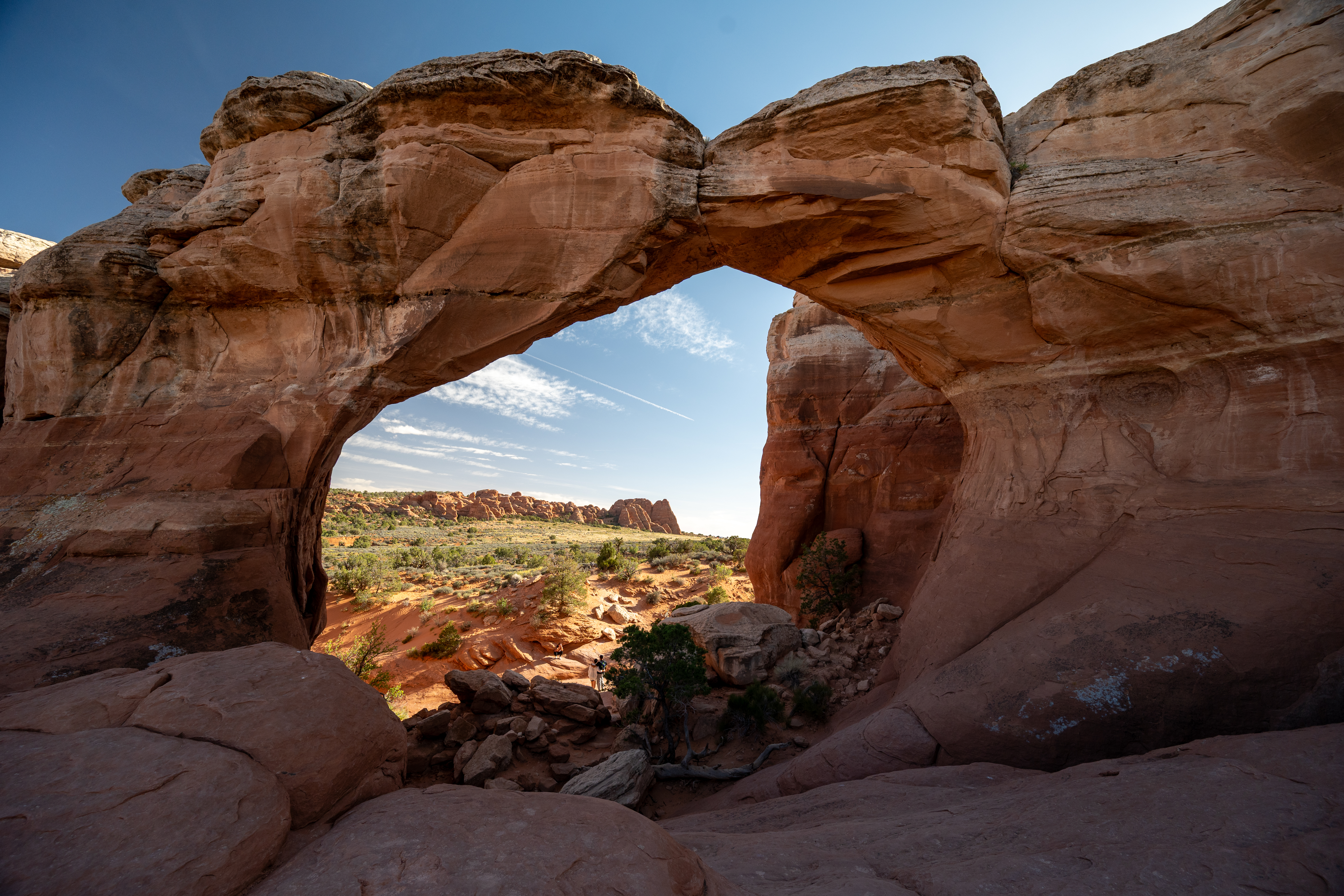
Navajo Arch requires a detour off the main loop, which keeps the crowds thinner. It’s a quieter, rounder arch than most in the park — the kind you step through rather than stand beneath — and the view of the canyon framed by its curve is one of my favourite shots from the whole trip.
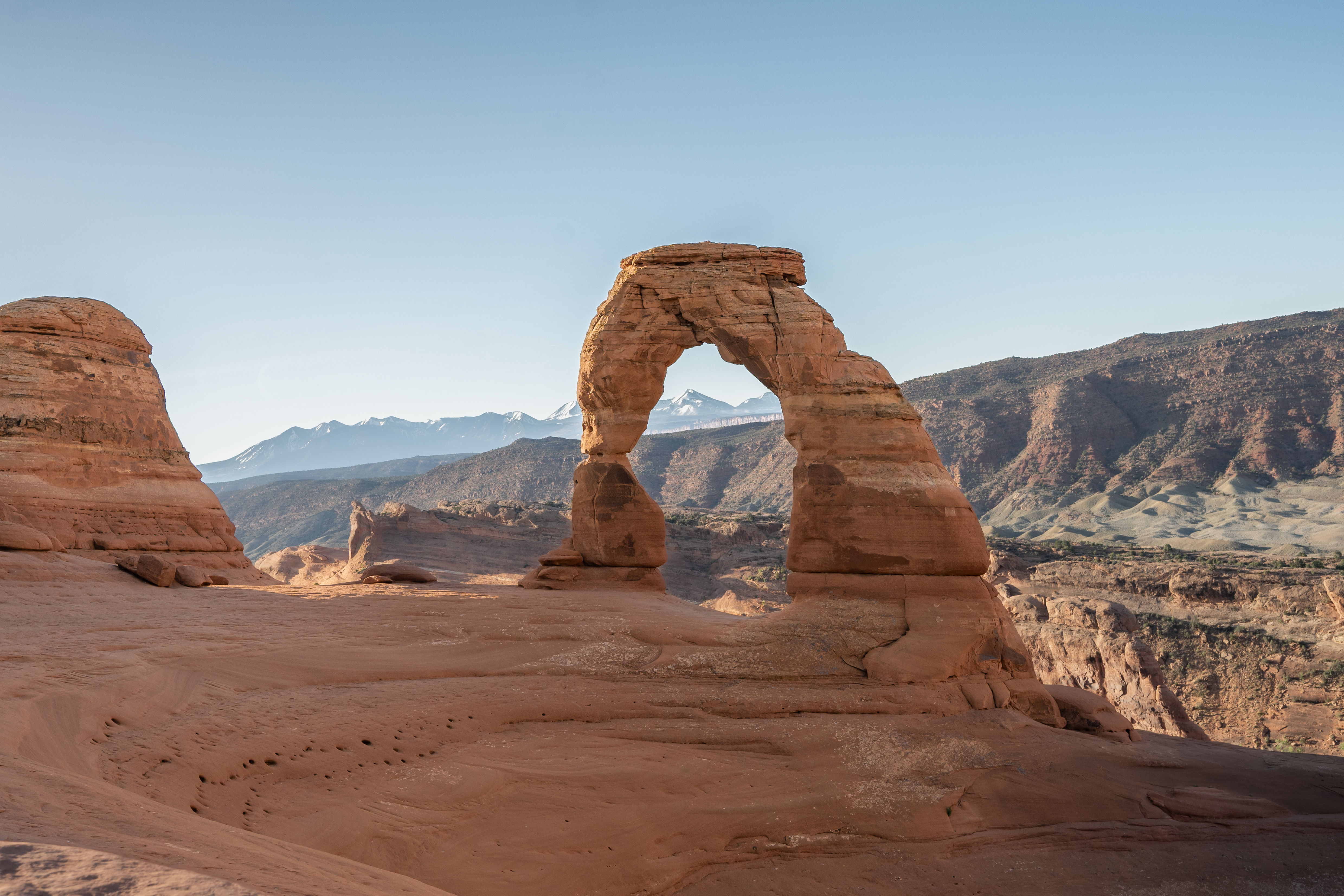
Save Delicate Arch for late afternoon. The 3-mile round trip earns its elevation gain, and if you time the light right, the arch glows in a way that explains why it’s on the Utah licence plate. The La Sal Mountains behind it, still carrying snow, complete the picture.
Dead Horse Point State Park
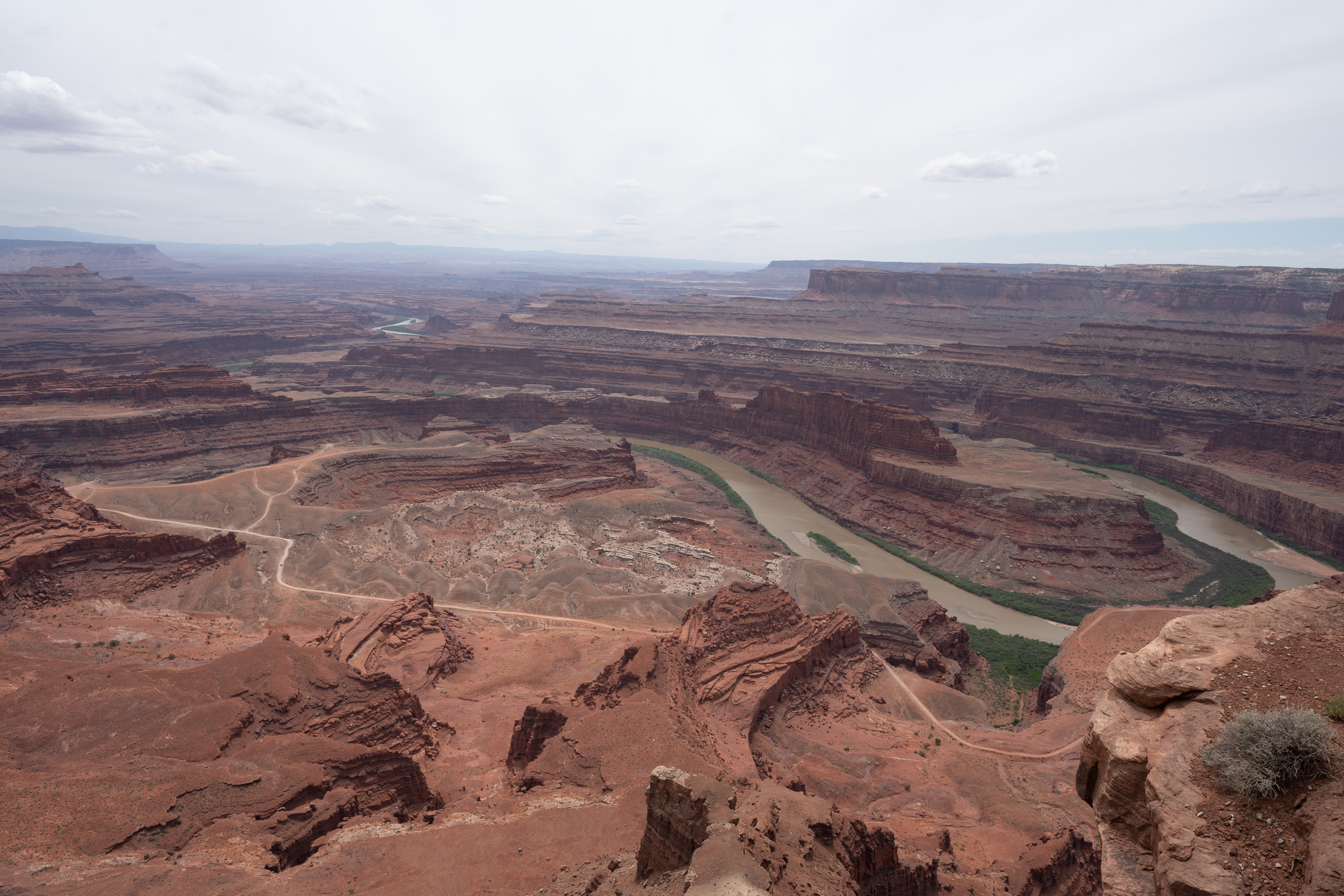
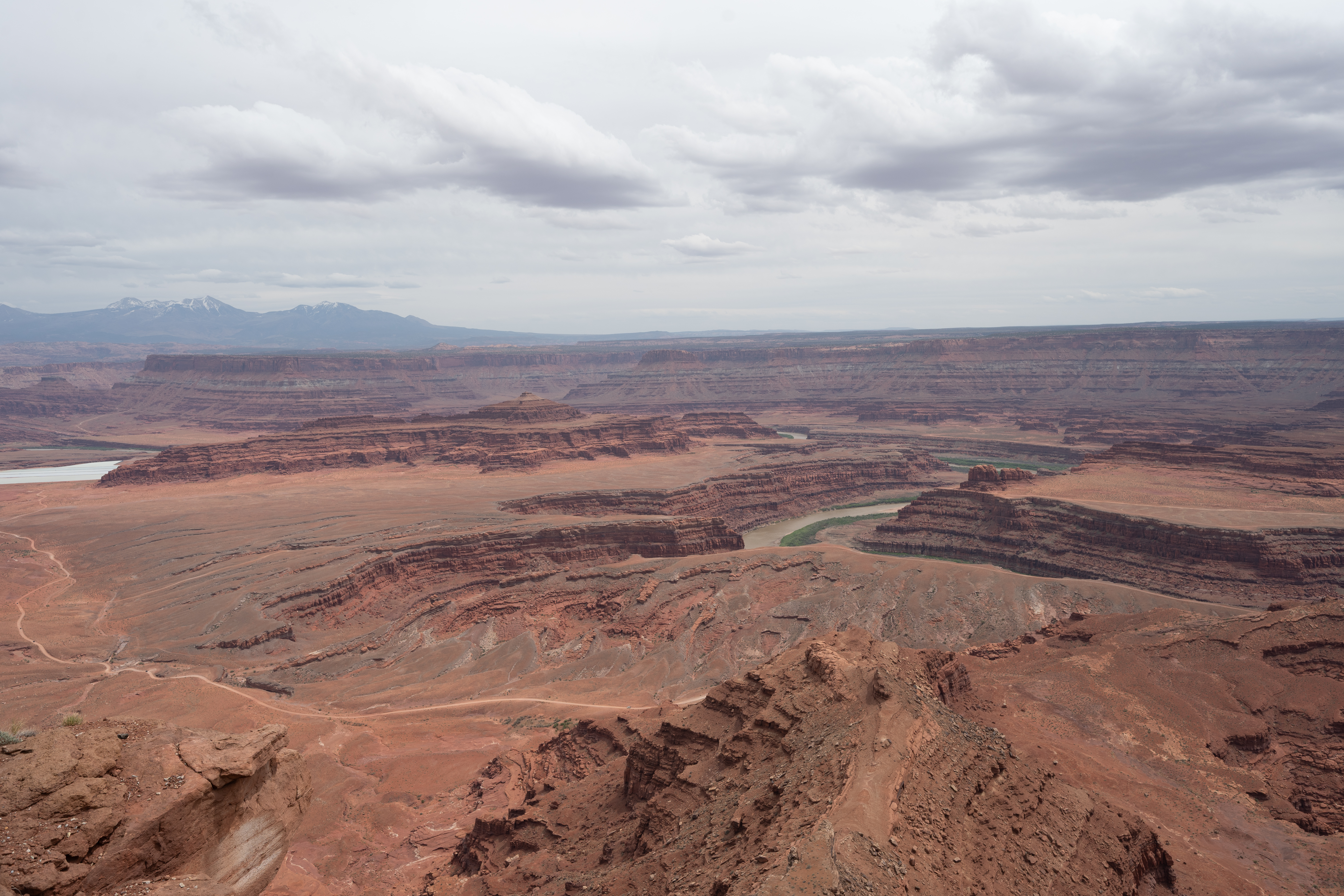
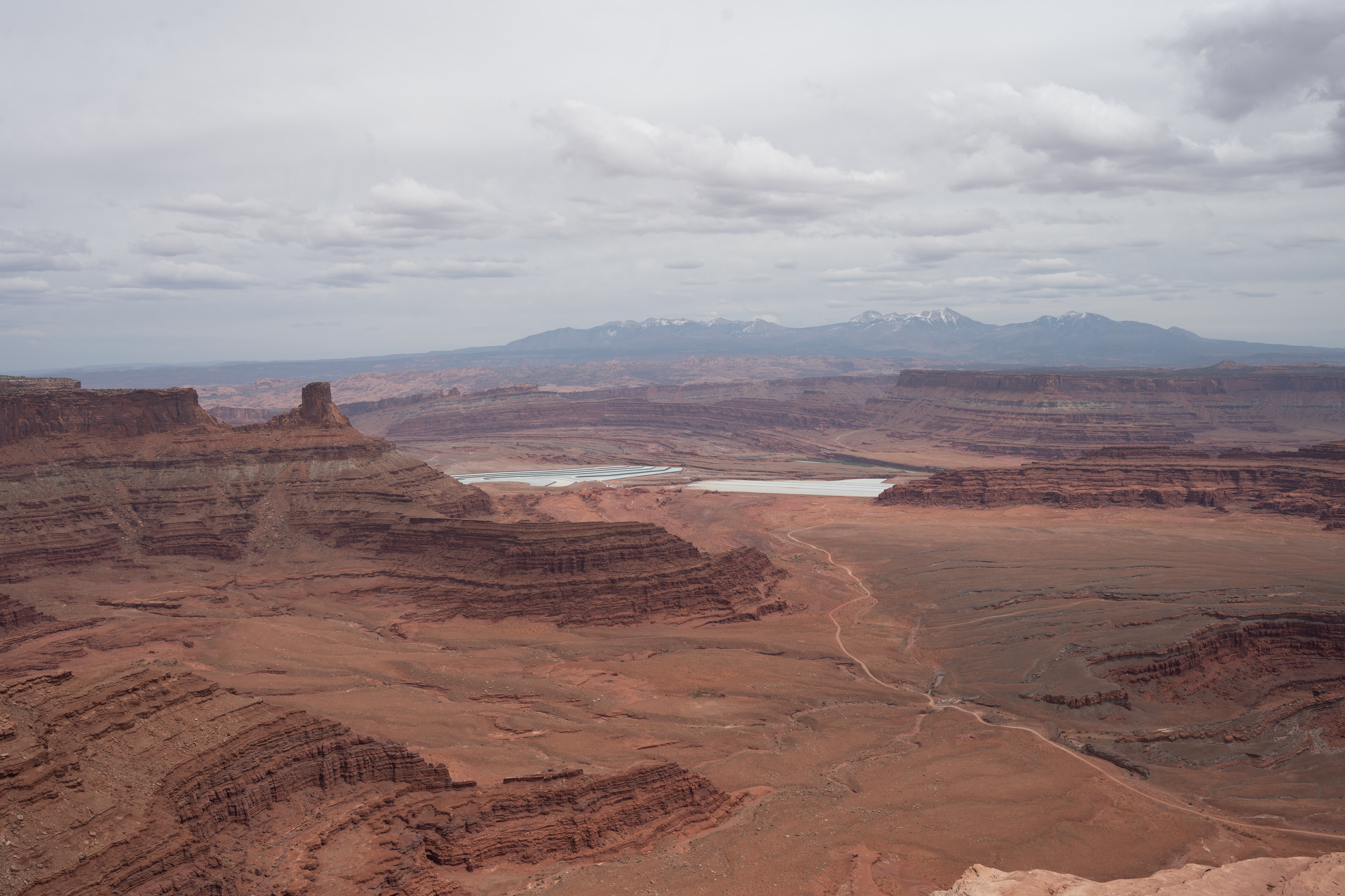
Most people make a detour to Dead Horse Point on the way from Arches to Canyonlands, and it earns the stop. The overlook sits nearly 600 metres above the Colorado River, which makes a horseshoe bend far below through a canyon that took an incomprehensible amount of time to carve. On a clear day you can see the turquoise rectangles of potash evaporation ponds in the distance — one of the few reminders that humans have been here at all.
Canyonlands National Park
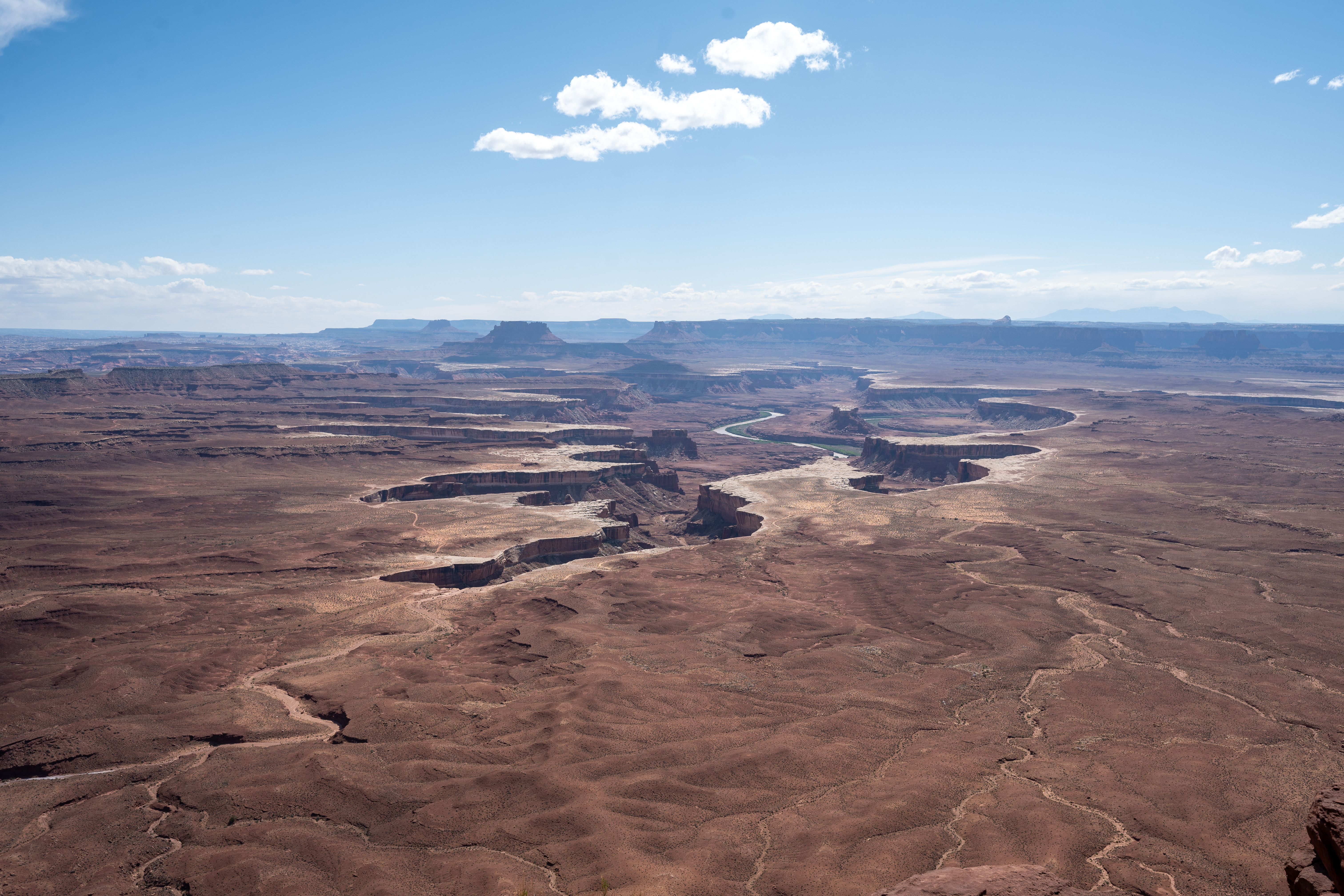
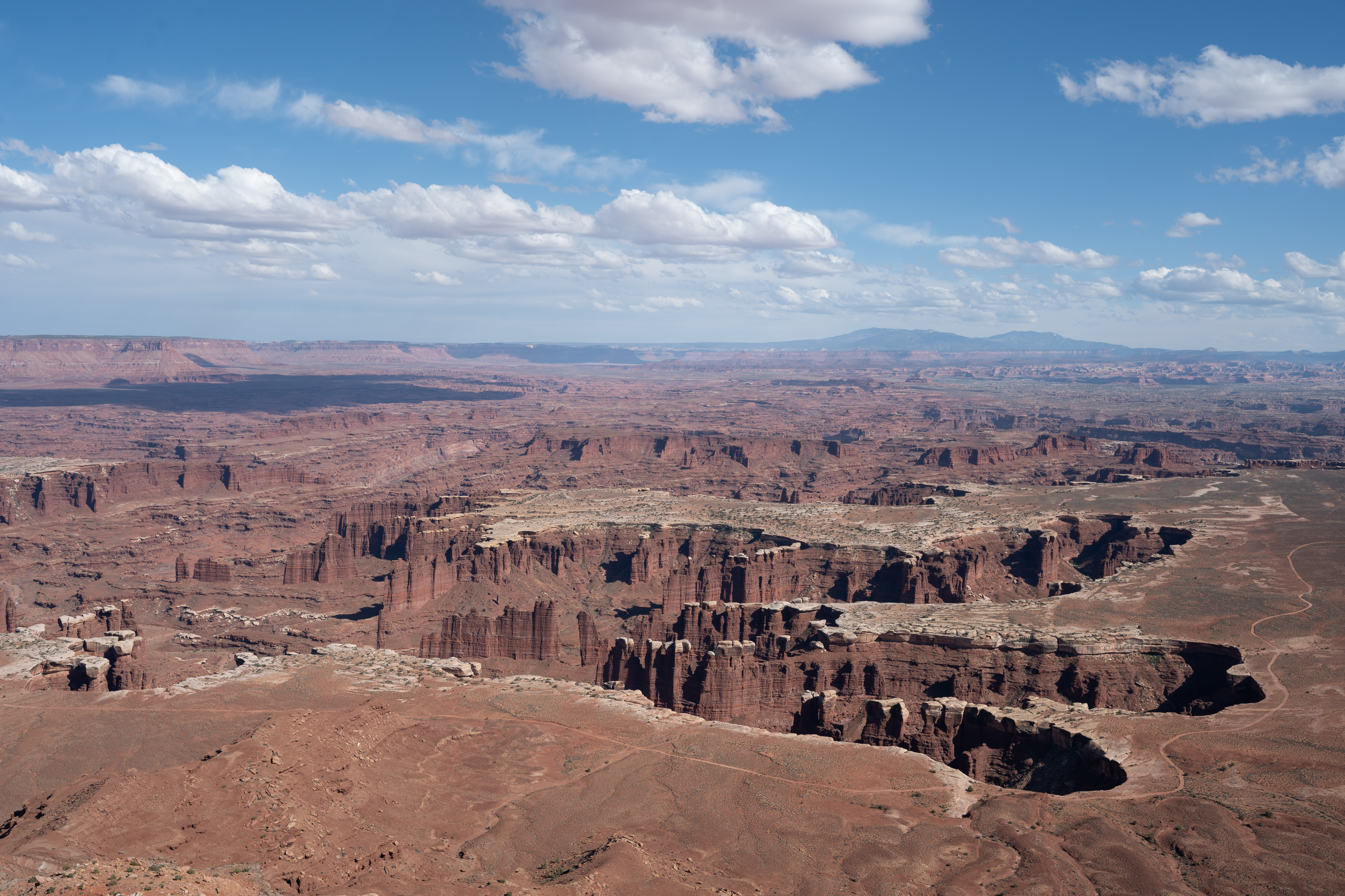
If Arches is about specific, individual formations, Canyonlands is about everything at once. The scale is so large that individual landmarks dissolve into a general vastness. Island in the Sky — the mesa district closest to Moab — offers a series of overlooks where you can see the Colorado and Green rivers cutting through the rock hundreds of metres below.
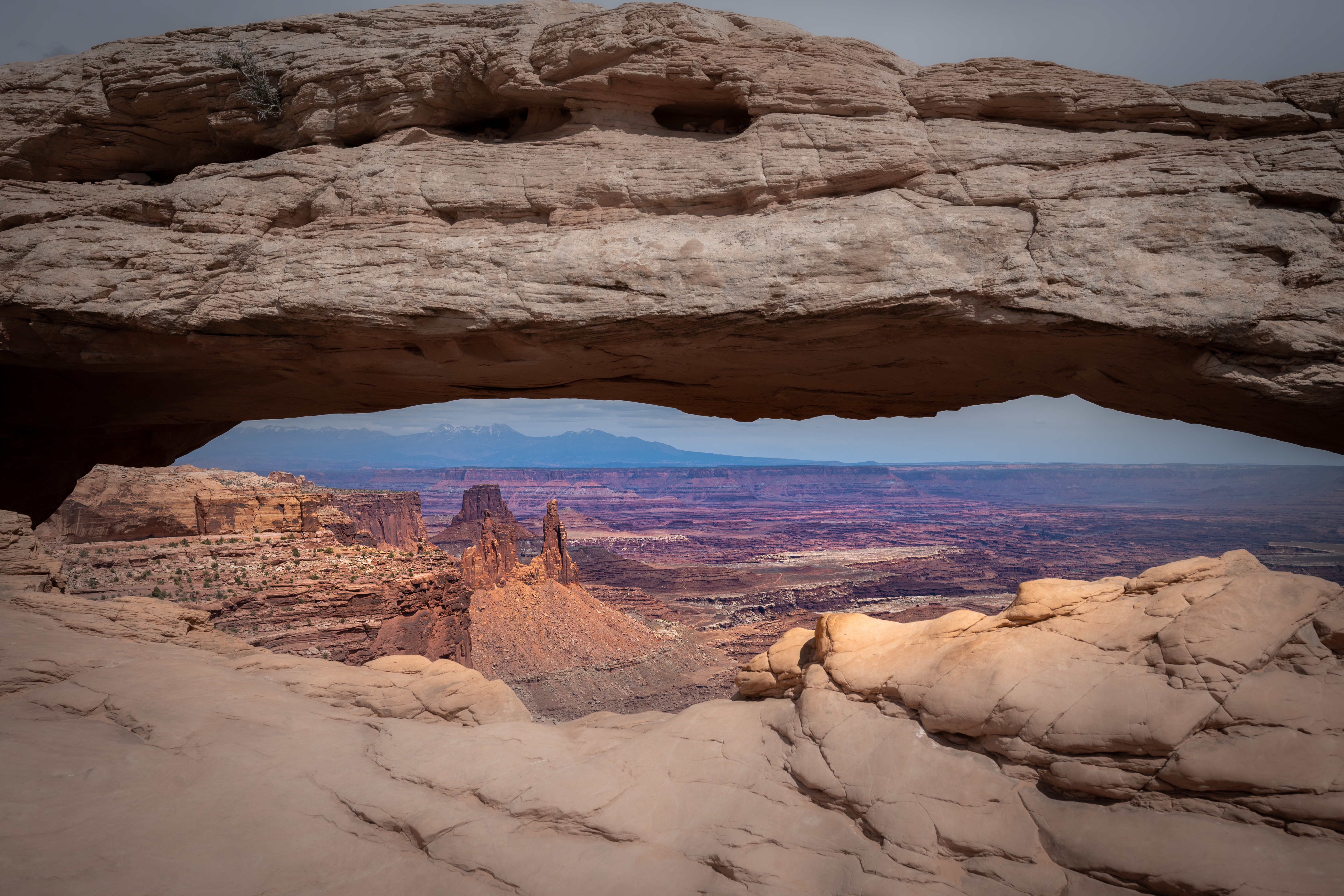
Mesa Arch is a short walk from the road and worth every step. The arch frames a drop straight into the canyon, and just after sunrise the underside of the rock lights up orange in reflected light from the canyon floor. I was there later in the day and still caught a beautiful view through the opening — the canyon stretching away to the horizon in every shade of red and purple.
The Green River Overlook and Grand View Point are the two best reasons to keep driving to the end of the road. At Grand View Point, the mesa simply ends and the world drops away in all directions. There’s no good photograph of it — the widest lens can only capture a fraction of the panorama. You just have to stand there and accept that it’s too large to hold all at once.
Three days is not enough for this country. It’s barely enough to understand how much you’re missing. I came back with full memory cards and the distinct feeling that I’d only scratched the surface — which, given that the surface here is a few hundred metres of sandstone, seems about right.