Banff National Park: The Canadian Rockies
There’s a particular colour that belongs to the Canadian Rockies and nowhere else — a blue-green that sits somewhere between turquoise and teal, the product of glacial rock flour suspended in meltwater. You see it in photographs and assume some enhancement has been applied. Then you arrive, stand at the edge of the water, and realise the photographs were actually underselling it.
That colour runs through everything in Banff. It’s in the rivers, the lakes, the smaller tarns that collect beside the road. It’s the first thing you notice when you drive in and the last thing you think about when you leave.
Banff Townsite
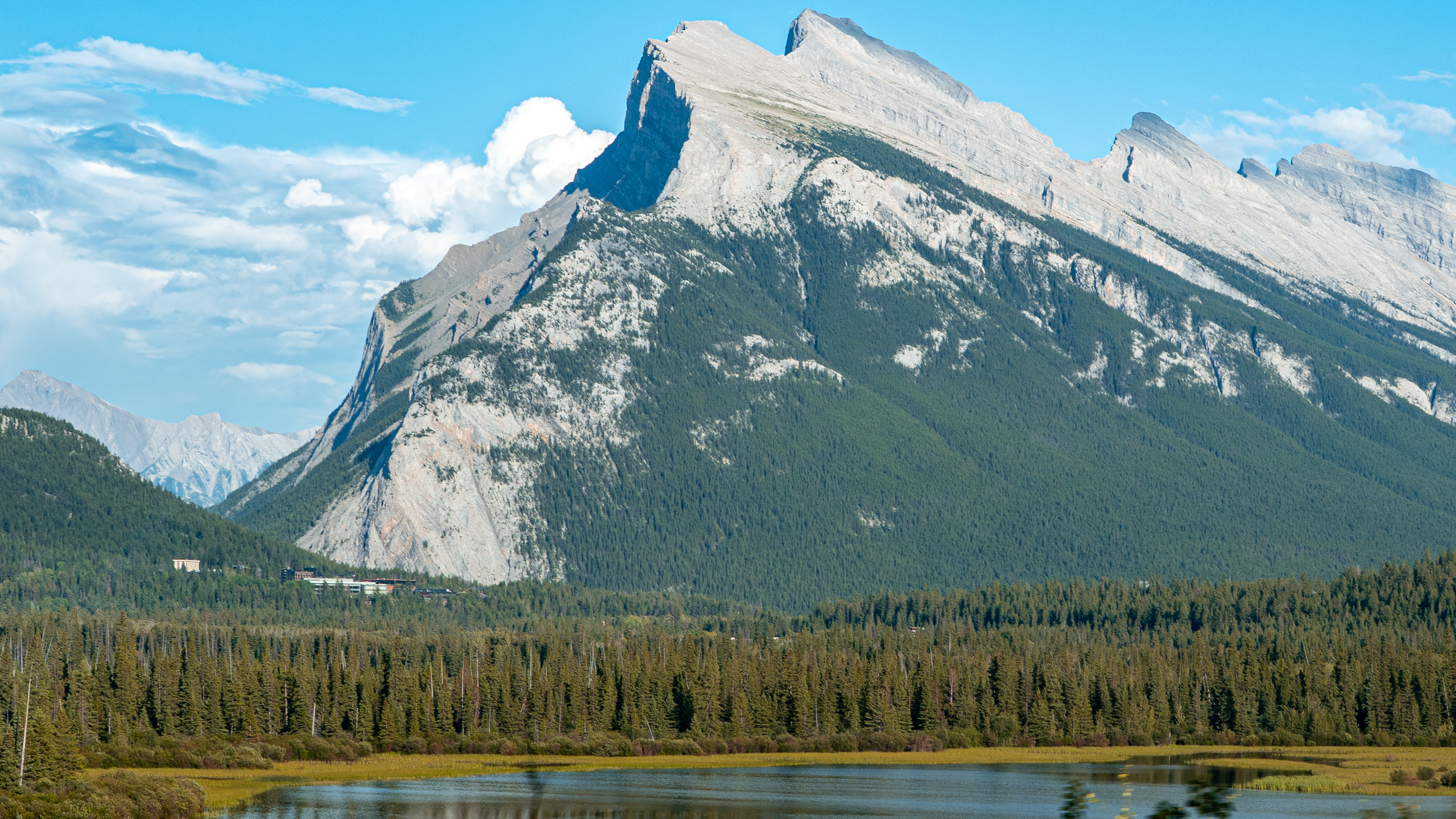
The town sits in a wide valley flanked on all sides by mountains that make no attempt to be subtle. Mount Rundle dominates the eastern skyline — a massive wedge of limestone tilted at a steep angle, its stratified face catching light differently at every hour. The classic view is from the Vermilion Lakes, a series of shallow wetland ponds just west of town, where on a clear morning the mountain reflects almost perfectly in the still water.
I arrived mid-morning with clouds beginning to clear, and the light was already doing something interesting — sharp and high-contrast, the kind you get in mountain country where the air is thin and the sky is genuinely blue rather than the bleached-out version closer to sea level.
The town itself is worth a few hours, but the pull is always outward. Every road out of Banff leads somewhere worth going.
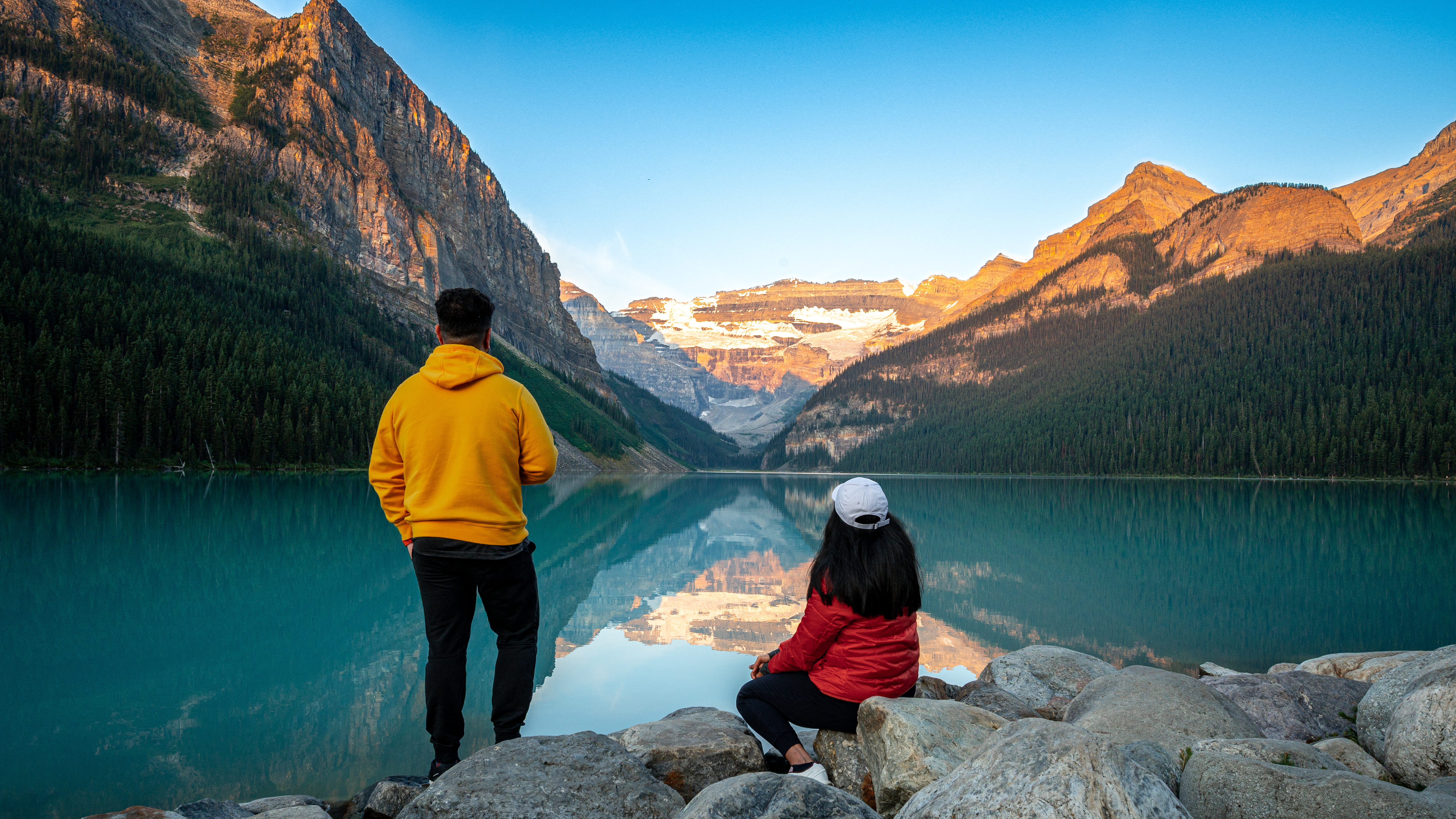
Lake Louise
Lake Louise requires an early start. Not because you need the light — though you do — but because by mid-morning the parking situation approaches chaos and the shoreline fills with people in a way that makes it hard to experience the place rather than just photograph it. Arrive before sunrise and you get both the light and the quiet.
The lake is fed by the Victoria Glacier, which terminates at the far end of the valley in a wall of blue-white ice. In the hour before sunrise, with the first alpenglow touching the peaks and the water carrying a perfect reflection of everything above it, the scale of the place becomes briefly comprehensible. Briefly — then the light changes and it becomes something else entirely.
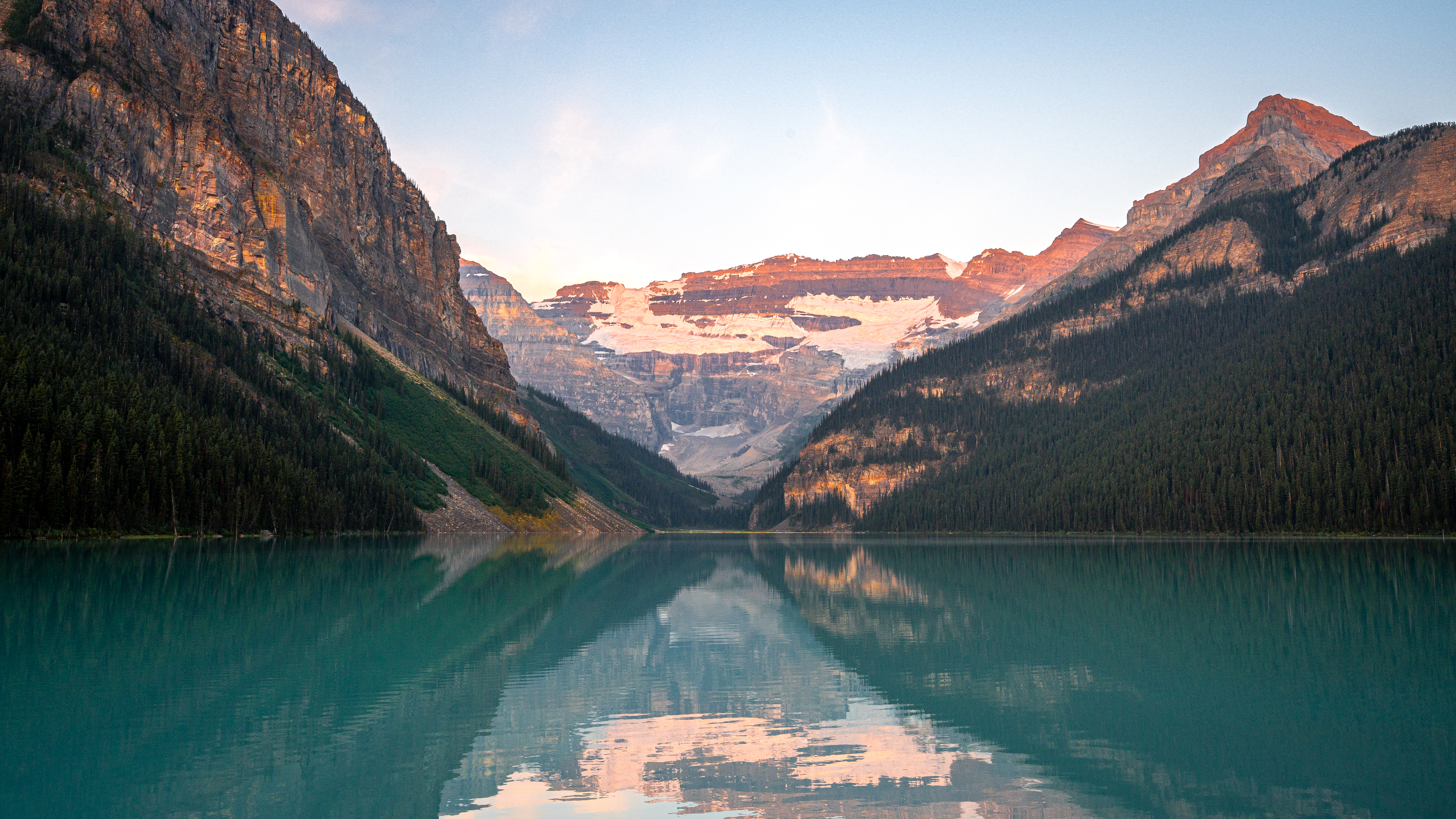
The reflection that morning was nearly perfect. No wind, glassy water, the mountains turning pink from the top down as the sun caught the highest rock first and the colour slowly descended. It’s the kind of thing that’s easy to stand in front of for a long time.
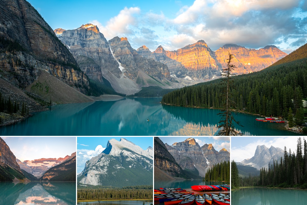
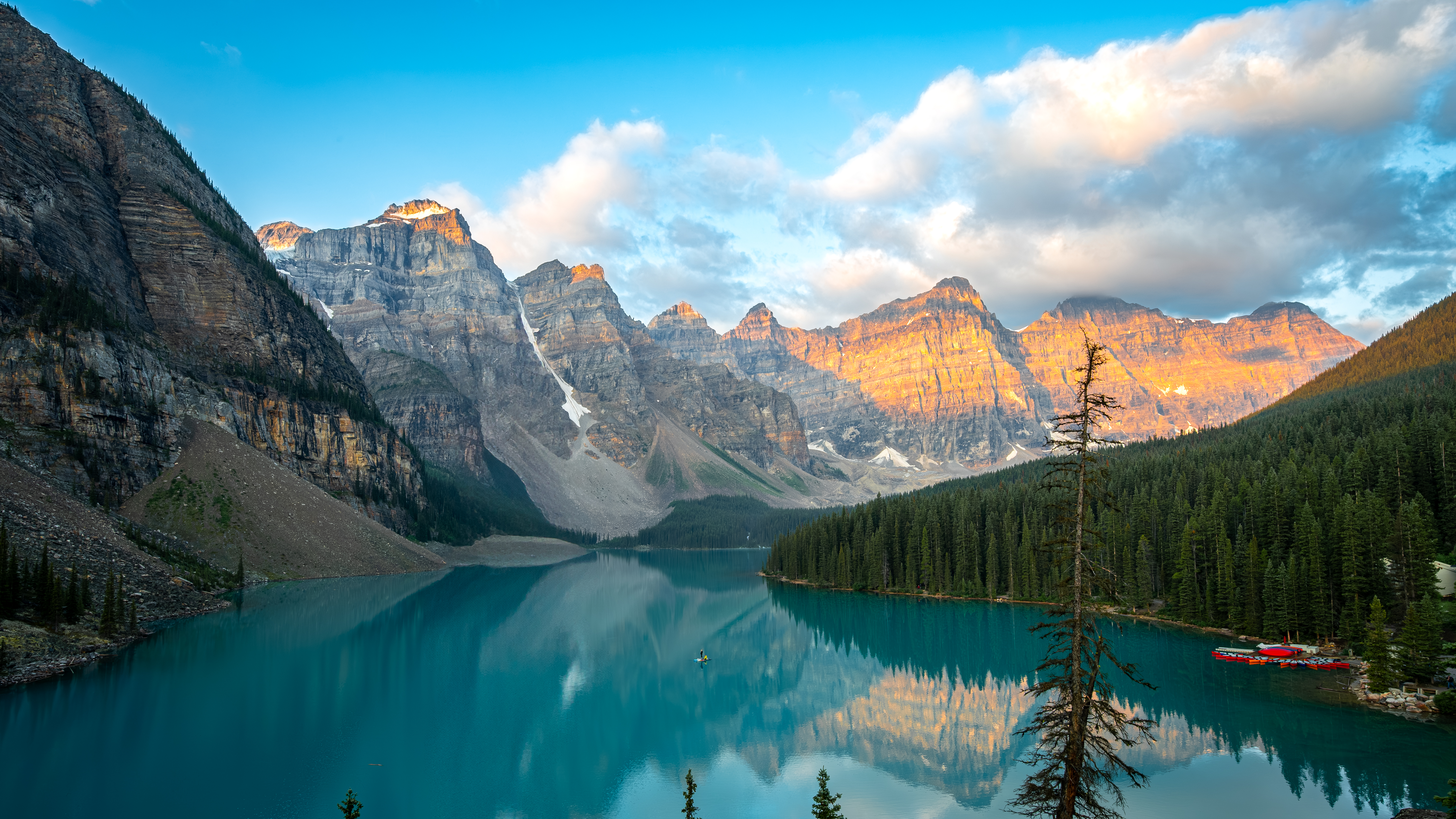
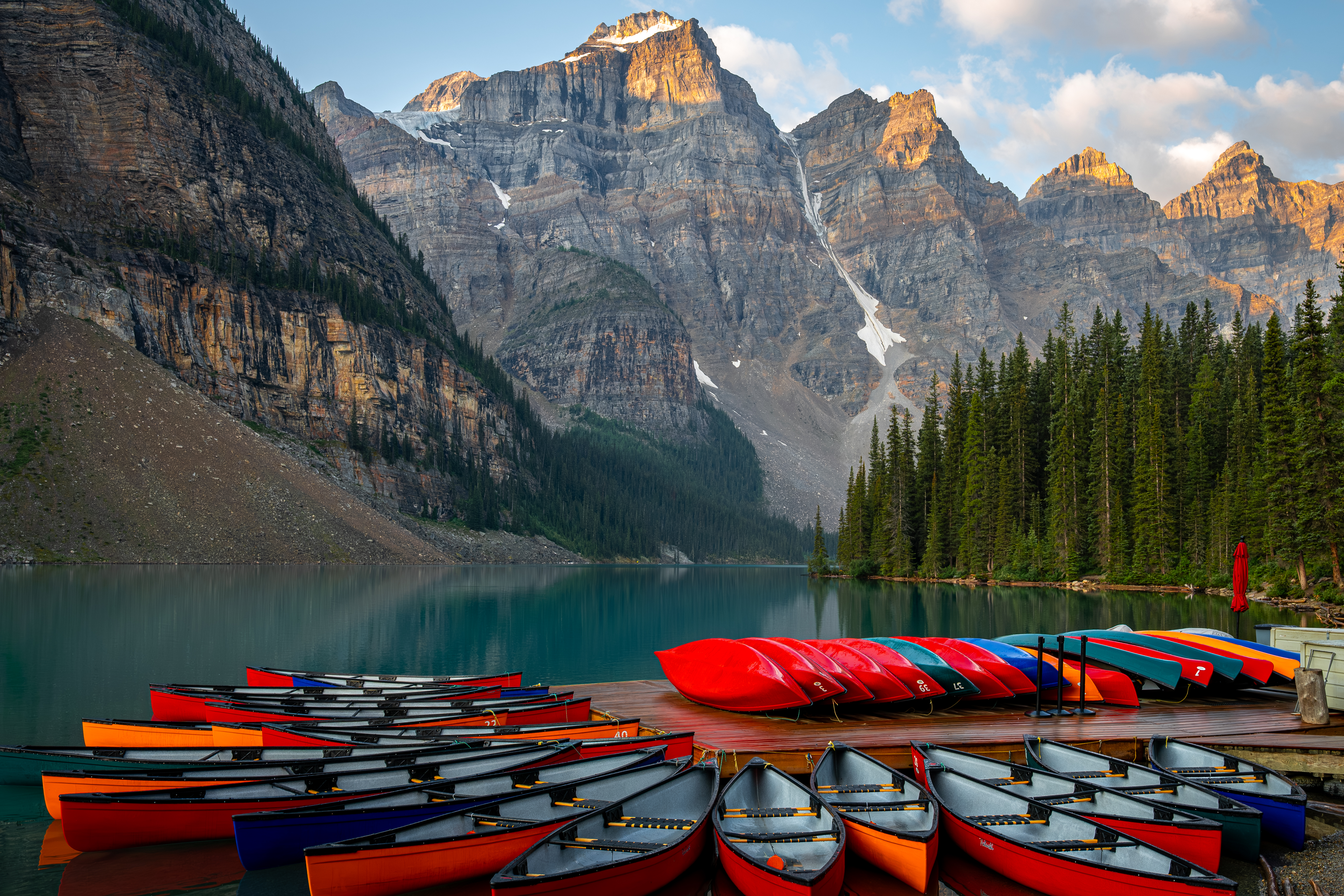
Moraine Lake
If Lake Louise is famous, Moraine Lake is the place that earned Canada a spot on its twenty-dollar bill. The view from the Rockpile — a short scramble over a glacial moraine at the lake’s edge — looks directly down the Valley of the Ten Peaks, ten summits arranged in a rough arc above the turquoise water. It is, without any exaggeration, one of the finest views on the continent.
The access road has been closed to private vehicles in recent years due to the crowds, which actually improves the experience considerably. Arriving by shuttle in the hour after sunrise, with alpenglow still burning on the highest peaks and the lake barely disturbed, felt like having the place to ourselves — or as close to that as anywhere this famous gets.
The canoe dock at the lake’s edge adds a particular foreground — red and orange boats stacked in rows, their colour a deliberate counterpoint to the blue-green water behind them. It’s the kind of composition that looks almost too composed, like someone arranged it. Nobody did. It just happens to be how they store the boats.
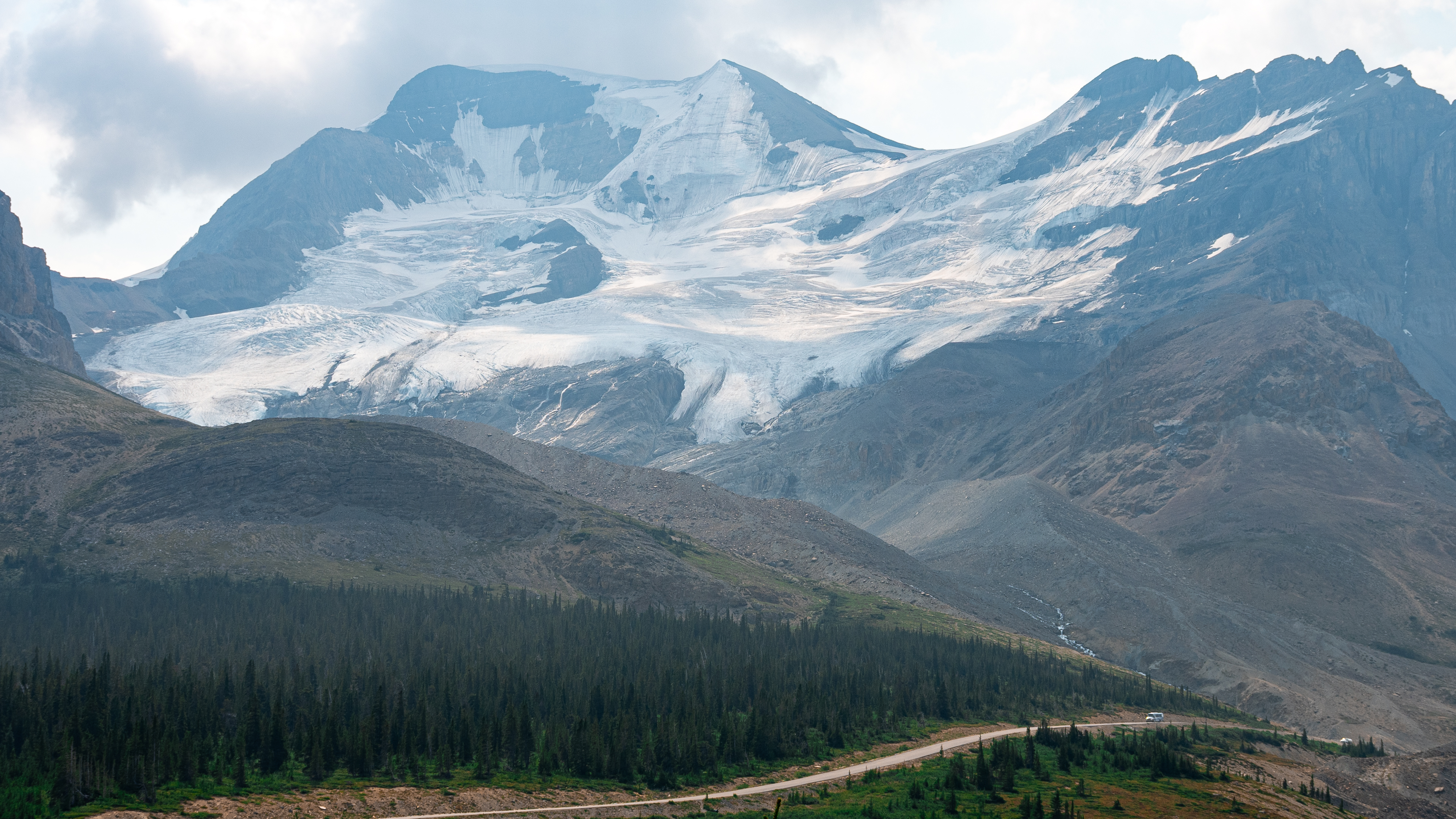
Icefields Parkway
The Icefields Parkway runs 232 kilometres from Banff to Jasper through some of the most consistently spectacular mountain scenery in the world. Most people drive it in a day. It probably deserves a week.
The highway climbs through successive passes, each one opening onto a new valley. Glaciers appear on the mountainsides with increasing frequency as you head north — first as distant smears of white, then as massive, slow-moving rivers of ice with visible crevasse systems and terminal moraines spreading out below them.
Athabasca Glacier is the most accessible of the Columbia Icefield’s outlet glaciers, spilling down from a vast snowfield at nearly 3,000 metres. From the roadside, the scale is hard to process — the glacier itself is enormous, but the icefield above it is larger still, spreading invisibly over the plateau. Markers along the trail record where the glacier’s terminus was in previous decades: 1890, 1920, 1950, each one further up the valley than the last. The ice is retreating visibly within a human lifespan.
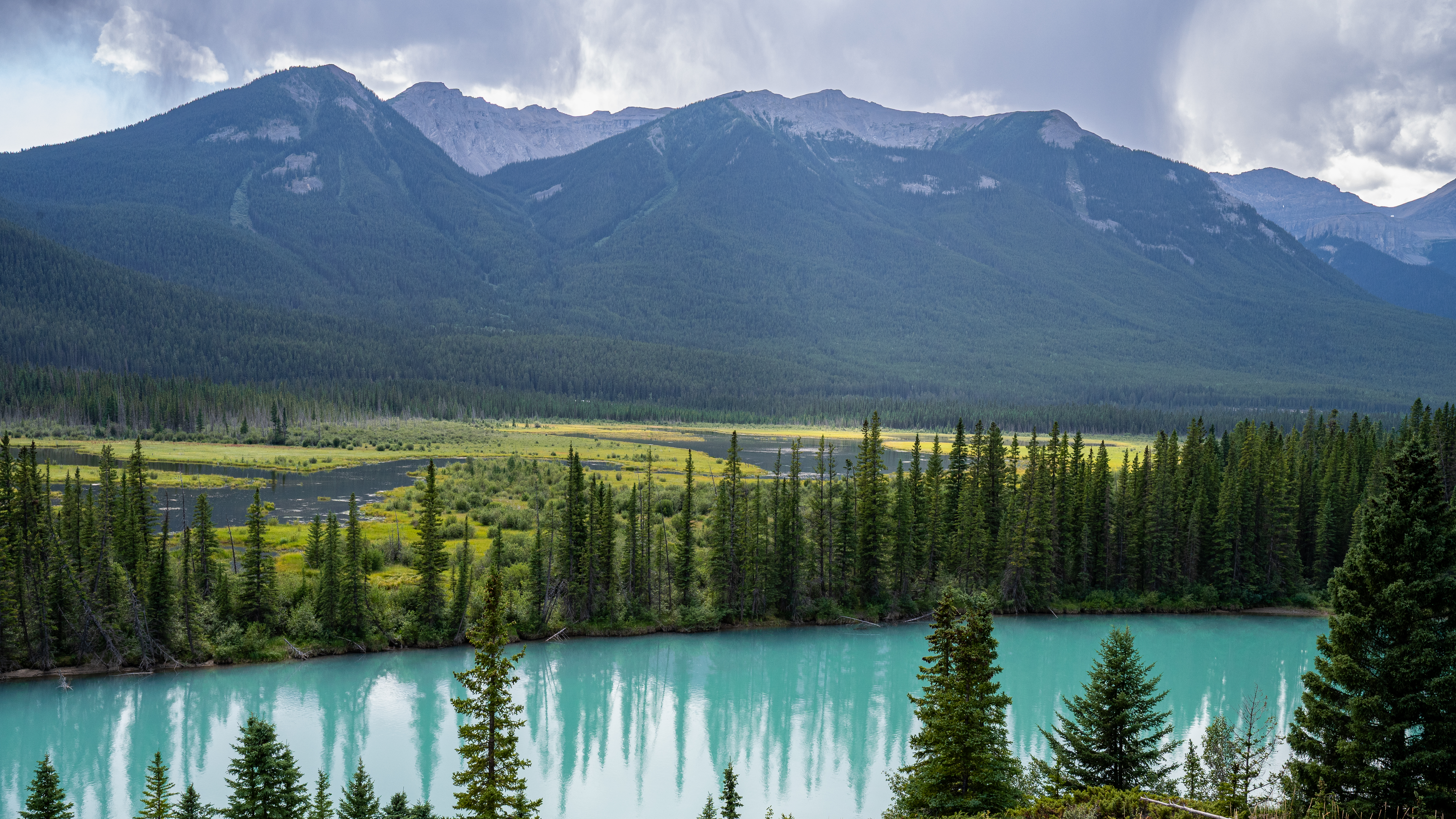
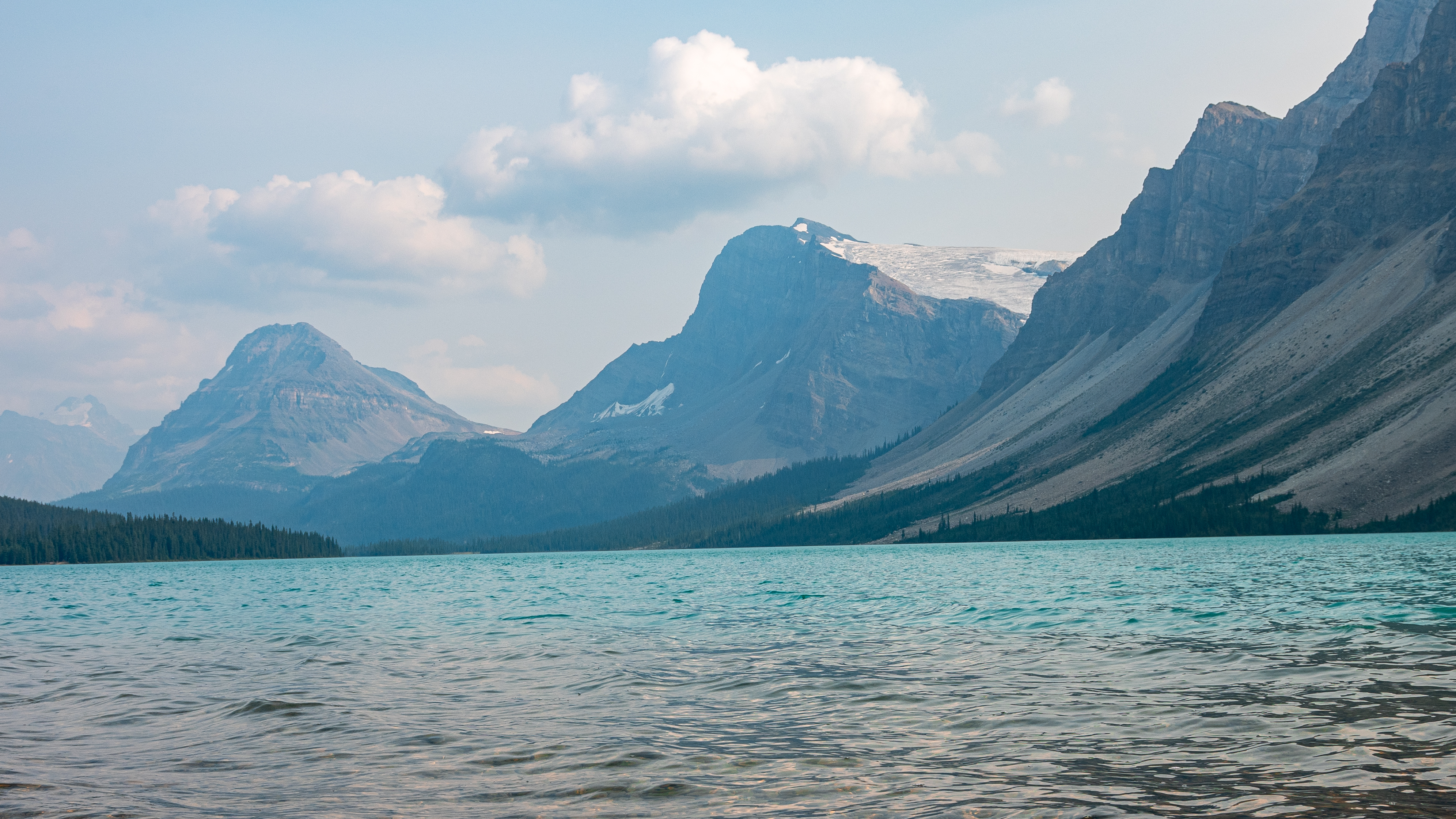
Bow Lake sits lower in the valley, fed by the Bow Glacier at its far end. On the afternoon I stopped, a light haze from distant wildfire smoke softened everything — the mountains took on a layered, atmospheric quality, each successive ridge a slightly lighter shade of grey-blue than the one in front of it. The water still held its turquoise, undimmed.
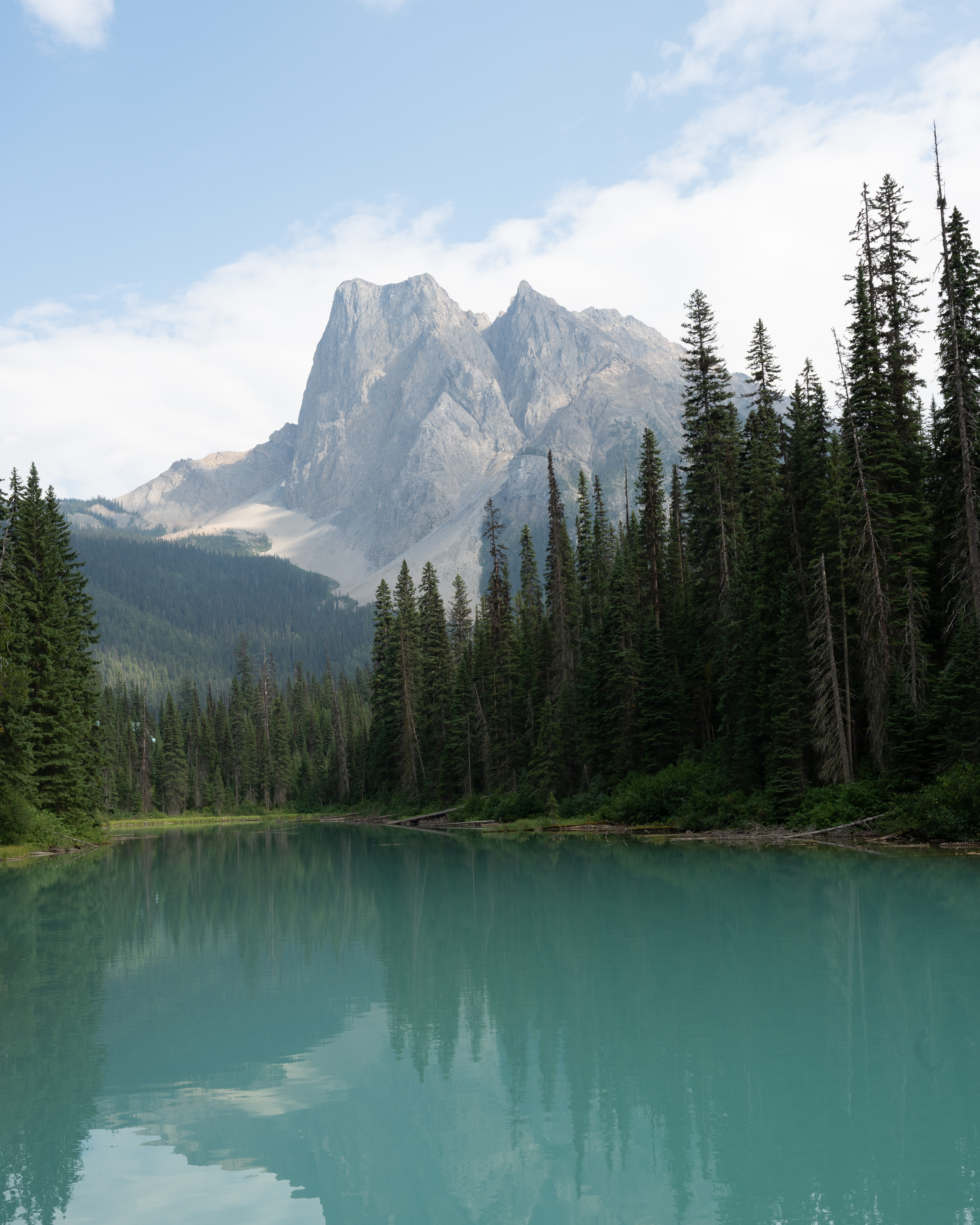
Emerald Lake
A short detour into Yoho National Park — just over the Alberta border into British Columbia — leads to Emerald Lake, which earns its name with more justification than most places named for a colour. The lake is smaller and quieter than Louise or Moraine, ringed by dense spruce and fir with Mount Burgess rising sharply at its far end. The reflection in the still water in the afternoon light was almost unsettlingly clear — the trees mirrored so precisely that the boundary between the forest and its reflection was hard to find.
The Canadian Rockies have an accumulative effect. Each individual view is extraordinary, but what stays with you is the overall weight of the landscape — the sense of being somewhere that hasn’t been scaled to human proportions, where the mountains are large enough and cold enough and permanent enough that human presence barely registers. That turquoise water runs through all of it, fed by ice that has been there far longer than anyone who comes to look at it.